SCAN TO BIM SERVICES
Scan to BIM Services
We provide precise BIM models derived from laser-scanned point cloud data, with a strong emphasis on accurately representing existing site conditions. Our Scan to BIM services enable effective design coordination and renovation planning by converting real-world conditions into discipline-specific BIM models that support construction documentation and asset management.
By leveraging advanced 3D laser scanning technologies and expert BIM workflows, we minimize site uncertainties and reduce rework, helping project teams execute with greater confidence. Backed by over a decade of global experience and a multidisciplinary engineering team, our Scan to BIM services support architects, engineers, contractors, and facility owners by delivering clarity, coordination, and reliability across all project phases.
Our Scan to BIM Services
We offer a comprehensive suite of 3D laser scanning and Scan to BIM services designed to convert physical environments into accurate, data-driven digital models. From on-site laser scanning to BIM and mesh conversion, each service is structured to deliver clarity, constructability, and confidence at every stage of the project lifecycle.
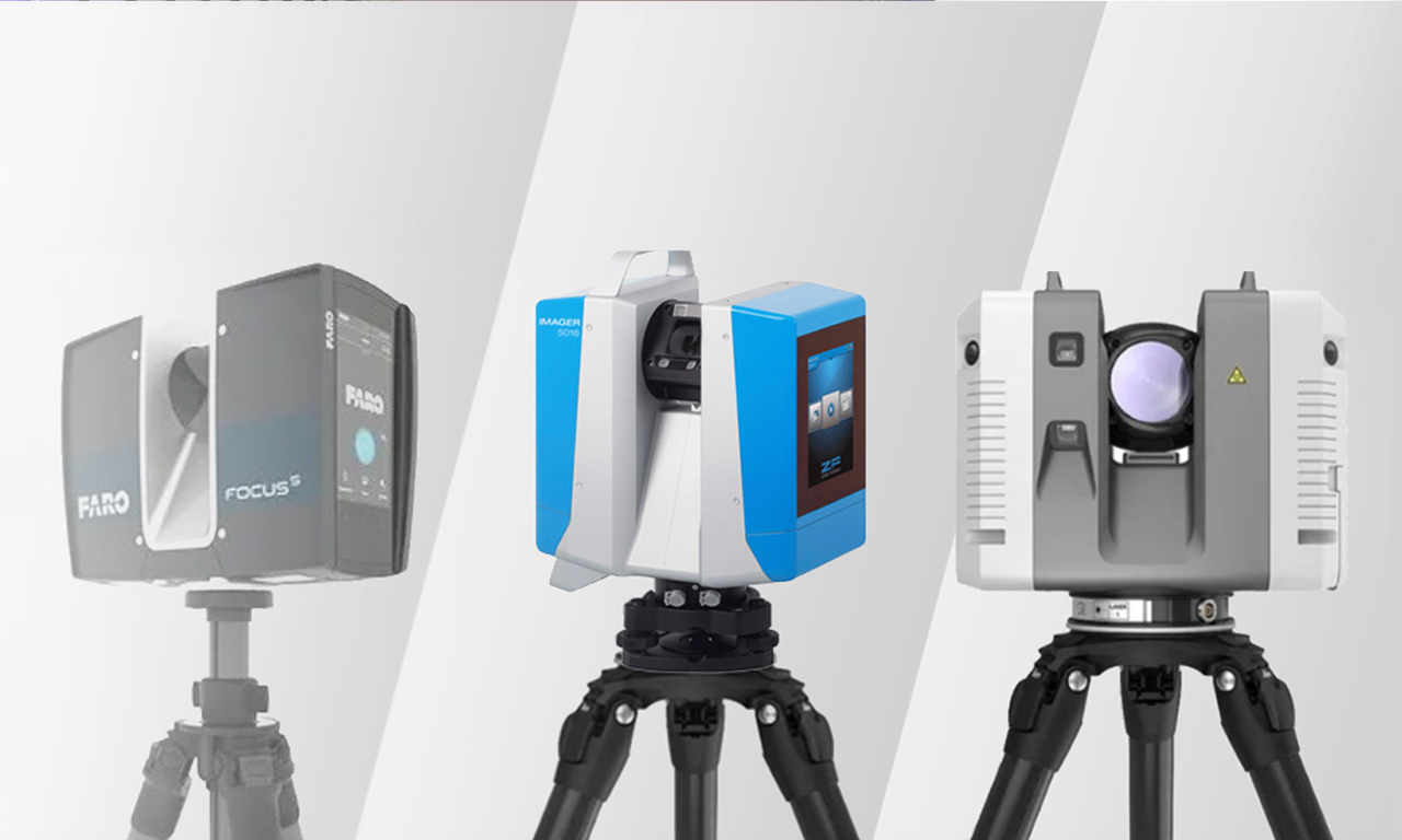
High-precision laser scanning workflows are used to capture existing site conditions with exceptional accuracy. Advanced terrestrial laser scanners generate dense datasets that are georeferenced, registered, and optimized for seamless integration into BIM and CAD platforms.
Deliverables include:
• Registered and cleaned point cloud datasets (RCP, RCS, E57, PTS, LAS)
• Deviation analysis reports comparing design intent with as-built conditions
• Scan alignment and registration documentation
• 360° panoramic scan images and site photospheres
• Modeling-ready point cloud datasets for BIM and CAD workflows
Each scan provides a dependable foundation for accurate modeling, validation, and digital asset creation.

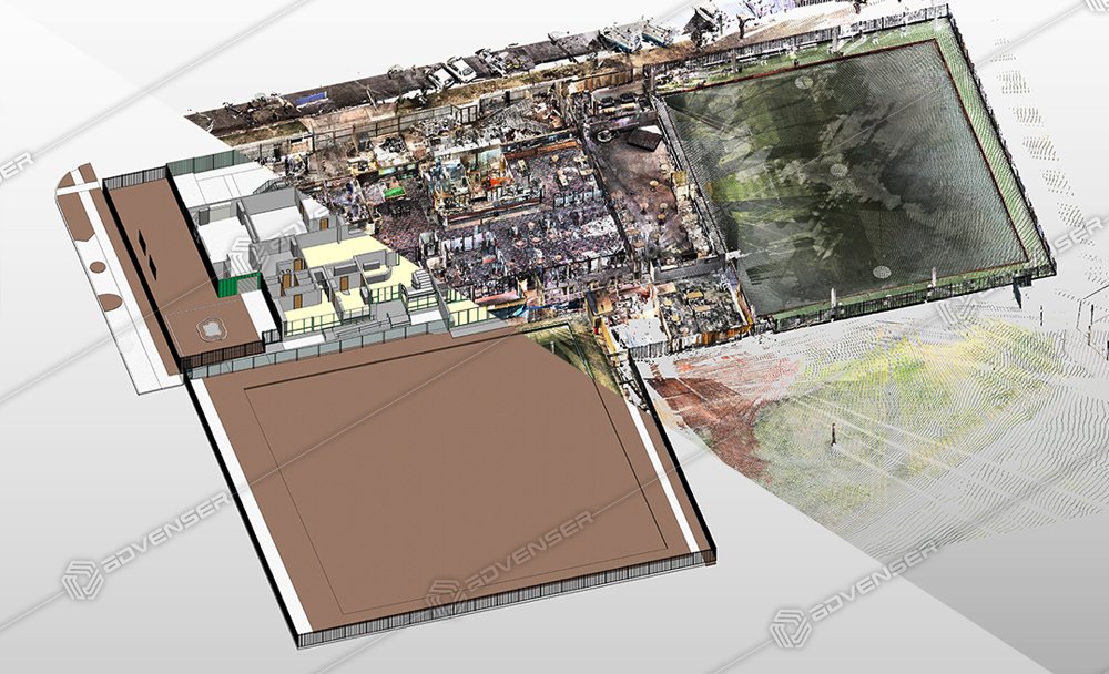
Registered point cloud data is converted into intelligent, parametric BIM models that accurately reflect existing site conditions. Architectural, structural, and MEP models are developed up to LOD 500, aligned with project requirements and international BIM standards.
Deliverables include:
• Revit BIM models for architecture, structure, and MEP disciplines
• As-built BIM models for operations, maintenance, and lifecycle planning
• Annotated 2D CAD drawings (DWG, DXF, PDF)
• CooPoint Cloud to Mesh Services
These models support design coordination, clash detection, renovation planning, prefabrication workflows, and digital twin integration.
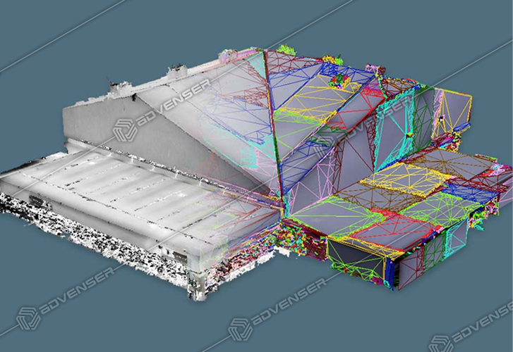
Point Cloud to Mesh services convert dense laser scan data into optimized, watertight polygonal meshes suitable for visualization, simulation, and digital twin applications. Using industry-standard tools such as Geomagic, ReCap, and Blender, meshes are generated for compatibility across engineering, design, VR, and analysis platforms.
Deliverables include:
• High-resolution polygonal mesh models (OBJ, STL, FBX)
• Surface-optimized meshes for visualization and analytical workflows
• Textured 3D models for VR/AR and presentation use
• Mesh-to-CAD conversions for fabrication and reverse engineering
• Digital twin–ready mesh data for asset monitoring and simulation
Each mesh balances visual fidelity with geometric accuracy, enabling high-performance digital environments.
International Standards We Adhere To
- ANSI – American National Standards Institute
- ASME – American Society of Mechanical Engineers
- ISO – International Organization for Standardization
- BSI – British Standards Institution
- DIN – Deutsches Institut für Normung (German standards)
- BNQ – Bureau de Normalization du Quebec
MEP POINT CLOUD MODELING
STRUCTURAL POINT CLOUD MODELING
INTEGRATED POINT CLOUD MODELING
POINT CLOUD TO
MESH
POINT CLOUD TO MESH
ARCHITECTURAL POINT
CLOUD MODELING